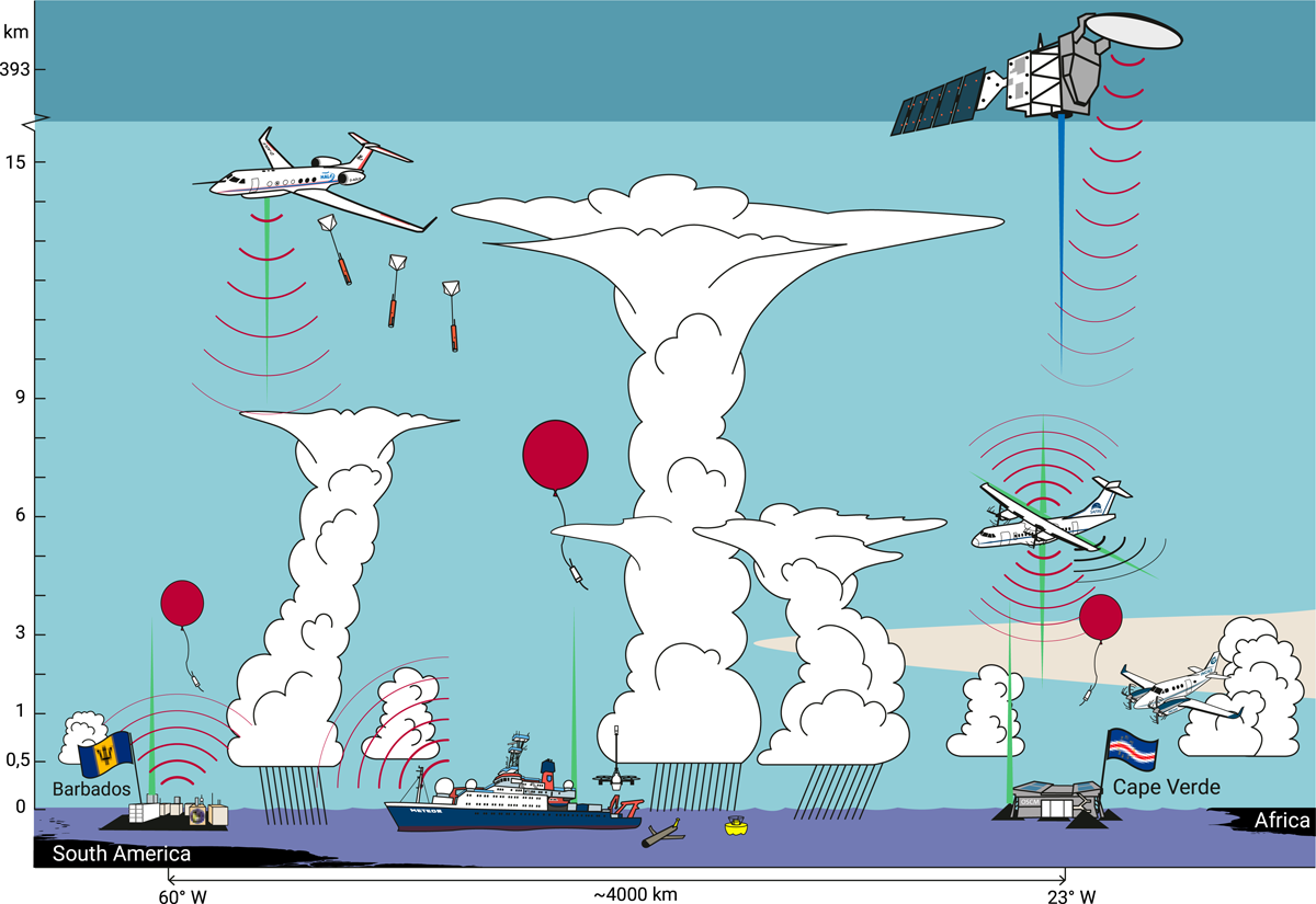
ORCESTRA: exploring tropical deep convection
ORCESTRA is an international field campaign dedicated to advancing our understanding of tropical deep convection (the towering clouds and thunderstorms that transport heat, moisture, and energy through the tropical atmosphere) and its role in Earth’s climate system. Conducted across the tropical North Atlantic from August to September 2024, the campaign brought together a unique combination of airborne, shipborne, ground-based, and satellite observations to investigate how convective processes organize and interact across a wide range of spatial and temporal scales.
As illustrated in the figure, ORCESTRA coordinated measurements from multiple research platforms, including the HALO high-altitude research aircraft, the SAFIRE ATR-42, the INCAS King Air, the Meteor research vessel, advanced ground stations in Cape Verde and Barbados, and the EarthCARE satellite mission. Together, these platforms performed extensive atmospheric soundings, radar and lidar remote sensing, aerosol and cloud observations, and ocean-atmosphere measurements across the tropical Atlantic.
The campaign harmonized eight interconnected sub-campaigns, combining complementary observing strategies and shared infrastructure to create an unprecedented observational framework for studying tropical convection. Measurements were coordinated across platforms and around EarthCARE overpasses, enabling detailed multi-scale observations of convective systems, cloud organization, atmospheric circulation, and air-sea interactions.
Beyond field observations, ORCESTRA is accompanied by extensive numerical simulations designed to support the development of a new generation of more physically realistic climate models. The campaign also emphasizes open science and collaboration through shared data policies, common operational tools, and coordinated outreach activities involving international partners across Europe, Africa, the Caribbean, and North America.
Their website serves as a central hub for the ORCESTRA campaign, providing access to documentation, operational reports, datasets, software tools, visualizations, and numerical simulations generated throughout the project.